River Don and Rotherham Lock

The South Yorkshire Navigation Canal is now capable of handling huge vessels, including European barges carrying up to 700 tons.
The canal largely follows the route of the River Don, and shares its course at several points. 700-ton barges can reach Mexborough: 400-ton vessels can continue to Rotherham: but the final miles into Sheffield are only suitable for pleasure boats or traditional cargo craft.Despite improvements in the 1970s and 1980s, the waterway remains under-used by freight traffic Recent improvements have therefore concentrated on attracting specific cargoes - for example, a new wharf for steel traffic at Thrybergh.
The canal is increasingly popular with pleasure boats, but is still comparatively quiet. It is predominantly but not entirely industrial, often providing a rural oasis in a built-up area. Navigational conditions along the Don may vary, especially after rainfall. The canal is popular with walkers and cyclists .The River Don has traditionally been rich in wildlife. A new project aims to encourage barn owls along the length of the waterway, supported by the Hawk & Owl Trust. Sheffield City Council is working to improve the water quality within its section, encouraging more wildlife to come to the canal.
In common with other waterways based on natural rivers, there is no consistent towpath along the length of the Sheffield & South Yorkshire Navigation. However, you can walk between Sheffield Basin and Rotherham Lock, between Mexborough, Conisbrough, Sprotbrough and Doncaster
 |
 |
 |
 |
 |
 |
 |
 |
 |
 |
 |
 |
 |
 |
 |
 |
 |
 |
 |
 |
 |
The River from Don Street
September, 2005 |
 |
 |
 |
 |
 |
|
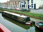
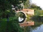
The first image shows the Chesterfield Canal at Kiveton Park Station
and the second, a few miles further on at Worksop.

 /p>
/p>
Chesterfield Canal from Welham to Hayton, Retford
Take a virtual cruise from Rotherham to Sheffield
Gallery Index
